
Weymouth is an excellent starting point for exploring the Dorset coast on foot, with routes ranging from an easy seafront walk to Bowleaze Cove to challenging full-day hikes along the South West Coast Path.
Heading east from Weymouth, walkers can follow the coast through Bowleaze Cove and Osmington Mills before continuing across the spectacular chalk cliffs to Durdle Door and Lulworth Cove. To the west, the South West Coast Path follows the Fleet Lagoon and Chesil Beach towards Abbotsbury, while the nearby Isle of Portland offers some of Dorset’s finest cliff-top walking.
Several of the longer linear walks can be combined with local bus services for the return journey, making it possible to explore substantial sections of the Jurassic Coast without having to retrace your steps.
Weymouth to Bowleaze Cove Walk
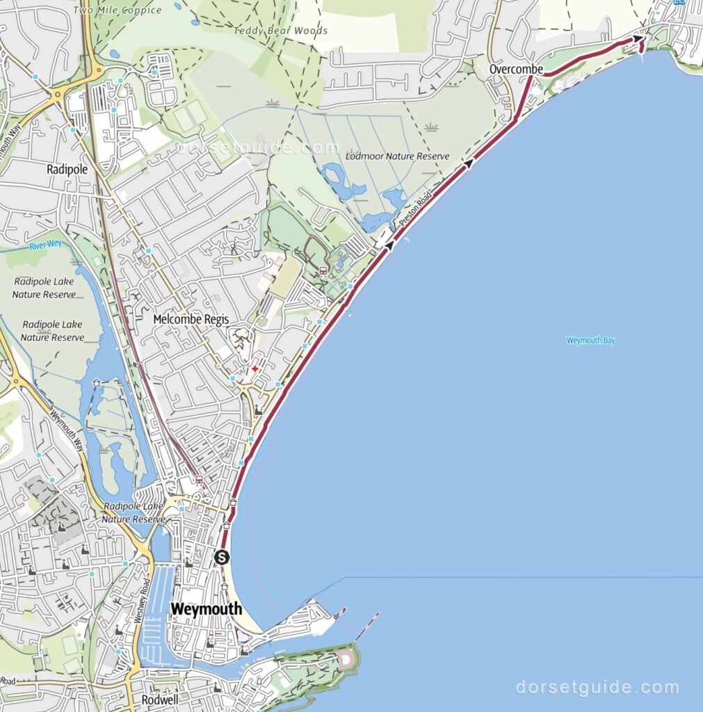
Distance: Approximately 2.4 miles (3.8 km) each way
Walking time: 1 hour
Route: Weymouth (King’s Statue) – Greenhill Gardens – Preston Beach – Look Out Cafe -Bowleaze Cove
GPS Map (external link): https://www.outdooractive.com/
Return Options
- Walk back the way you came
- Return to Weymouth (King’s Statue) on the 13 bus service from bus stop (Google map) https://www.firstbus.co.uk/
Weymouth to Osmington Mills Walk
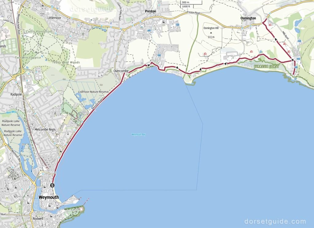
Distance: Approximately 5.9 miles (9.4 km)
Walking time: 2 hours 35 minutes
Route: Weymouth (King’s Statue) – Greenhill Gardens – Preston Beach – Look Out Cafe -Bowleaze Cove – Osmington Bay – Osmington Mills – The Smugglers Inn – Bus Stop (A353) Osmington (Google map)
GPS Map (external link): https://www.outdooractive.com/
Return from Osmington Garage bus stop (Google map) to Weymouth on the Jurassic Breezer 30, X50, X54, 5 service.
Weymouth to Lulworth Cove Walk
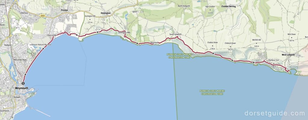
Distance: Approximately 11.3 miles (18.2 km)
Walking time: 5 hours 45 minutes
Route: Weymouth (King’s Statue) – Greenhill Gardens – Preston Beach – Look Out Cafe -Bowleaze Cove – Osmington Bay – Osmington Mills – The Smugglers Inn – Ringstead Bay – Burning Cliff – White Nothe – Durdle Door – Man O War Bay – Stair Hole – Lulworth Cove
GPS Map (external link): https://www.outdooractive.com/
Return to Weymouth from the Lulworth Cove Car Park bus stop (Google map) on the Jurassic Breezer 30, X50, X54 service
Weymouth (Ferrybridge) to Abbotsbury SWCP Walk
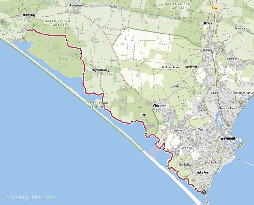
Distance: Approximately 10.8 miles (17.4 km)
Walking time: 4 hours 30 minutes
Route: Weymouth (Ferrybridge) – Chesil Beach – East Fleet – Fleet – Abbotsbury (Swannery Car Park)
GPS Map (external link): https://www.outdooractive.com/
This is the official route of the South West Coast Path. The nearest bus stop is outside the Ilchester Arms in Abbotsbury village which is a 12 minute uphill walk from the Swannery Car Park. The X52 / X53 run back to Weymouth https://www.firstbus.co.uk/
Isle of Portland Circular SWCP Walk
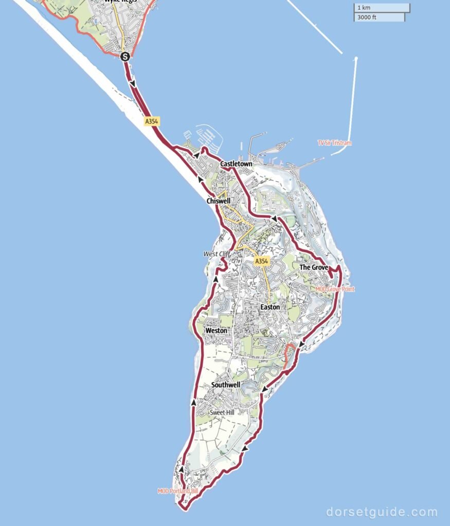
Distance: Approximately 13.7 miles (22 km)
Walking time: 6 hours 35 minutes
Route: Weymouth (Ferrybridge) – Portland Castle – Verne High Angle Battery – Church Ope Cove – Portland Bill Lighthouse – Chesil Beach Viewpoint – Weymouth (Ferrybridge)
GPS Map (external link): https://www.outdooractive.com/
Best of Isle of Portland Walk
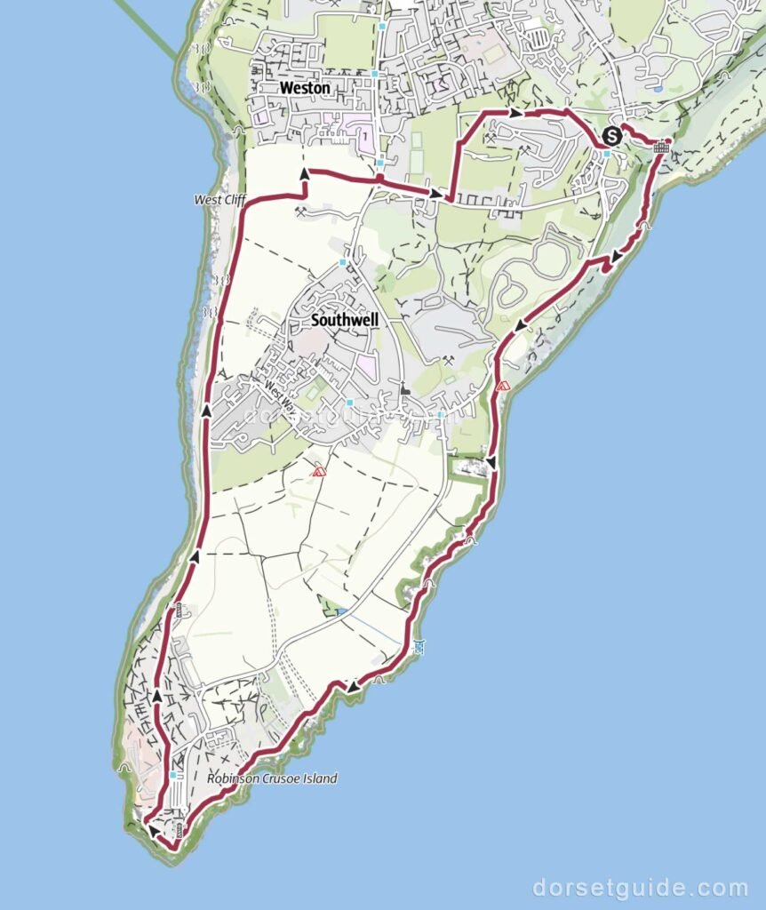
Distance: Approximately 5.8 miles (9.3 km)
Walking time: 2 hours 50 minutes
Route: Church Ope car park (Google map) – Portland Museum – Rufus Castle – Church Ope Cove – Portland Bill Lighthouse – Church Ope car park
GPS Map (external link): https://www.outdooractive.com/